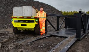
The difference technology can make in helping mining companies bridge gaps between public policy goals and bona fide results is becoming pretty clear in the mine rehabilitation area, with some of Australia’s top miners tapping AI, cloud-software and drone survey advances to reset the course of the world’s biggest vegetation monitoring programs.
They have done that through work with a fast-growing team of computer scientists and spatial ecologists at a Perth-based start-up, Millcrest Technology, whose founder Dr Cam Mounsey says the firm is ready to scale its offering globally over the next 2-3 years.
BHP and Newcrest Mining are two long-term users of Millcrest’s proprietary machine learning model, Tyton AI, and cloud-based Tyton EIS analytical tool.
Other companies operating on vast tracts of Western Australia’s Pilbara and Murchison regions are also using the technology, which leverages ML and relatively cheap drone-generated high-resolution aerial imagery – as well as imagery from conventional aircraft and satellite sources – to allow landholders to measure and monitor vegetation in rehabilitation in mining and surrounding areas.
These areas can be tens of thousands to hundreds of thousands of hectares.
“Our AI application is built to be scalable,” Mounsey told InvestMETS.com.
“Things over here are big and so it’s been built with that Australian mining scale in mind.
“We can assess very large areas at high resolution for an economical price.”
Mounsey spent about eight years at BHP and the Australian Defence Force, returning to the University of Western Australian in between to get a doctorate in restoration ecology. He had “a passion” for remote sensing and its ecological applications and set up a consulting firm that has also expanded. He also saw a need for the broader technology set.
“It was clear then [circa six years ago] we were seeing this real confluence in the availability of high-resolution aerial data, cloud computing capabilities and machine learning. And so those three things have come together,” Mounsey said.
“Before that people would do remote sensing at course resolutions. Like, that’s vegetation and that’s not vegetation. In the Pilbara you would detect vegetation through vegetation indices that identify green vegetation. So spinifex, or triodia, one of the most common vegetation types in the Pilbara, doesn’t show up on these things. It’s perfectly healthy, it’s just not always green.
“It pushed us down this machine learning path pretty quickly.”
Thousands of ground-truthing hours and billions of data pixels later, Tyton EI was fired up late last year.
“It used to be that people thought you needed to use hyperspectral data to start separating species and those sorts of things. But with machine learning some of these models are throwing 150 million parameters at these questions,” Mounsey said.
“It’s at a level well beyond what a person can devise or a rule-based system can come up with.

“Suddenly you can extract way more information out of relatively limited inputs. In the case of mining, it’s using the data most companies capture in standard aerial surveys.
“We believe we have created the most powerful ML solution available for automated detection and classification of individual vegetation lifeforms, target genres and species of interest across landscapes that might be tens of square kilometres to thousands of square kilometres.”
In an era of increasingly granular public reporting, and in some parts of the world regulatory oversight, around environmental, social and governance issues deemed crucial to the market reputation and operating licences of mining companies, Millcrest’s timing couldn’t be better (albeit tech funding has temporarily retreated).
Similar to the convergence of technologies, mining’s concurrent challenges to go green and be seen as a future-facing career destination, while maintaining and even growing historically high production levels, are merging into a perfect storm demanding technology-led change.
“It’s primarily about understanding your environmental liabilities,” Mounsey said.
“In the past transects or quadrats have been used to conduct on-ground monitoring.
“An area, which might be less than 1% of the total area under management, is assessed as representing the other 99%. You’ve got people doing estimations, which can mean further variance of up to 20%.
“Because you’re reporting on your quadrat that’s in this great piece of rehab … and you’re sending that information back through the company each year, that is all that is going to be captured for that site year after year.
“When it comes time to hand over the land package the regulator is not just going to look at that quadrat, they’re going to look at the whole site. And if it’s highly variable and performing particularly badly in one area or another, you’re going to fail.
“But if you can see your entire site you really do know what’s going on at that site.
“We also do a lot of riparian vegetation monitoring. That might cover entire creek systems [and] 3000 hectares-plus of territory. The owner might be either removing water from the system, or re-watering … So they use this technology to make sure that it’s not changing that vegetation community structure too much.
“This technology allows companies to look at an individual rehabilitation polygon and its characteristics and what aspects it’s passing and failing on. They can step out and look across the entire mine site and aggregate all the quadrats to identify site-wide trends and issues.
“They can step out to a hub or cluster of mines nearby.
“And then if they want they can step out across all of their operations and start to understand the key areas where they’re passing or failing, and where they need to put more effort.
“I believe this level of oversight is really important and this is one of the first times that we’re building towards that position where you are able to quantify what your rehabilitation liability is with some certainty rather than trying to extrapolate a single quadrat out, or a few quadrats out, to represent several hectares, and then doing that again and again over many hundreds or thousands of hectares.
“We’re seeing a much greater appetite for people wanting to have quantitative targets to really know what’s going on at their site so they can understand their liabilities.”
Some of the companies Millcrest is working with provide potential avenues into other markets.
Mounsey sees considerable opportunity to take a unique technology-led business model – not heavily service and people dependent – and expand.
“There are lots of characteristics about vegetation that are common regardless of where you go,” he said.
“I could send you to somewhere in Europe and you could still say that’s a tree and that’s a shrub and that’s a weed, and it’s similar for the model.
“You might want to calibrate it for particular species signatures, particular weeds or whatever; you might need to do some training for that.
“But there’s a level of classification that means that once the model has enough underlying training data, you’ve got a huge head start compared to starting from scratch.”